UTM Endurance, everything takes place around the breathtaking landscape of Marão (the entrance to a Marvellous Kingdom) and its foothills: Alvão, Aboboreira, Castelo de Matos and Meia Via. These are rugged mountains of singular beauty, with crystal-clear streams runningbetween each section of the route, breathtaking natural landscapes and villages of purecharm. The Marão Vertical KM and Senhora da Serra await you! An adventure through imposing mountains that will challenge your physical strengthand where only the most vigorous will achieve victory.
UTM ENDURANCE


120KM
7500m D+
32 HOURS LIMIT

Sector 1
Sector 1
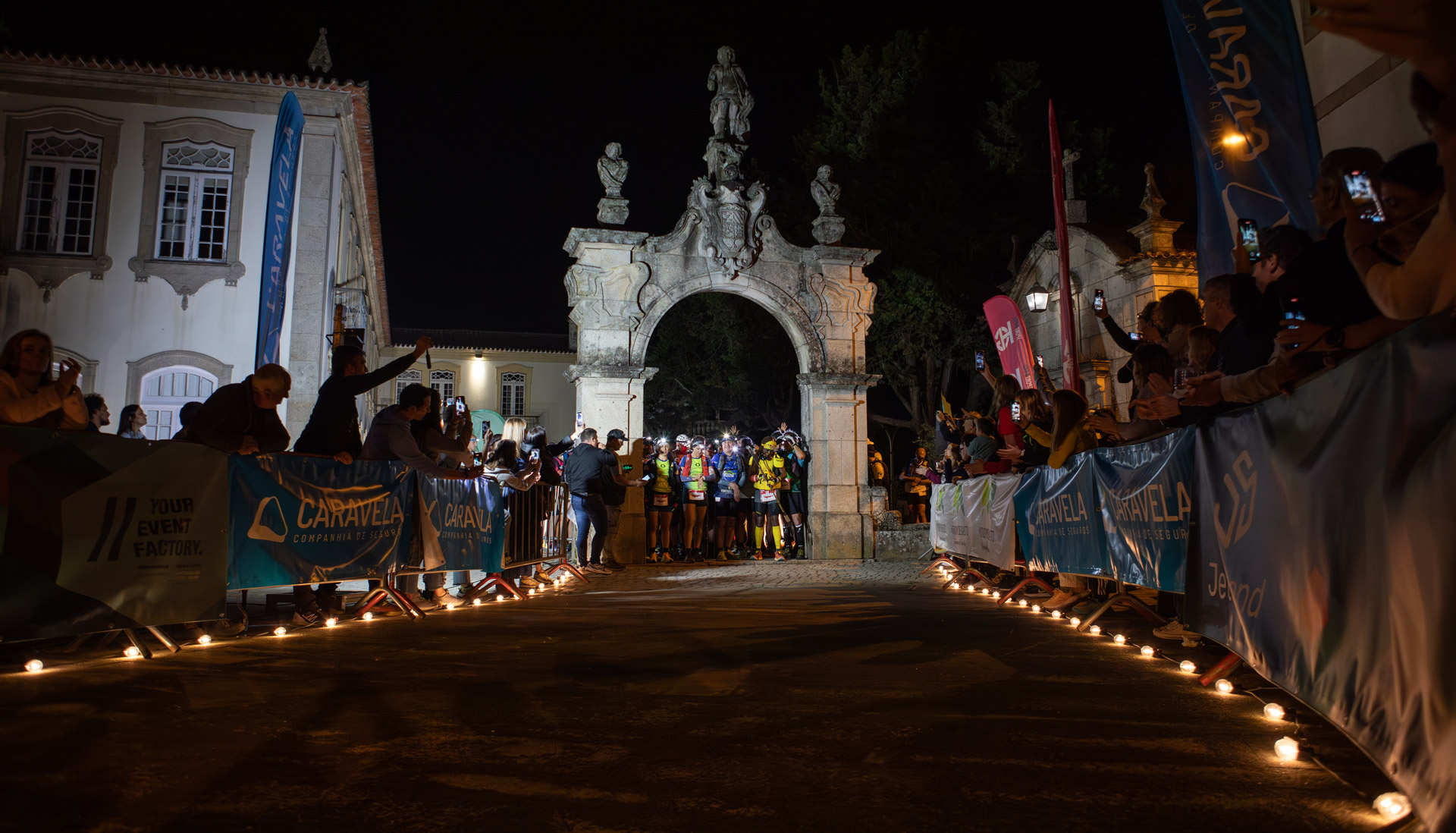
The challenge begins with a short ride through the historic centre of Mondim de Basto, a town in Trás-os-Montes with many traces of Minho influence. From here you’ll leave the town, either on rural roads or on trails, always climbing Monte Farinha. Once you’ve reached the iconic Sanctuary of Nossa Senhora da Graça, a must-see with privileged views at an altitude of 900 metres, after taking your time as far as the eye can see, you lose elevation and ride along the stunning Levada do Piscaredo, the Cabril and Cabrão rivers, the Mestras and finally arrive at Fojo.
Refuelling point: Fojo
15.5 Km // 1,111 mD+ // 774 mD-
Maximum time: 4h30′
Time limit: 1h30′
GPS coordinate: 41.37973;-7.87877
Team: GDR Juventude das Ribeiras
Sector 2
Sector 2
We are now travelling through the ex-libris of the Serra do Alvão. After passing through the beautiful village of Varzigueto, a traditional village of shepherds and herdsmen, made up of rural houses built of granite and with thatched roofs, we come to the most emblematic place in the protected area of the Alvão Natural Park, a breathtaking and vertiginous landscape with the stunning Olo River, the powerful waterfalls of the Fisgas de Ermelo, its many waterfalls, the Piocas. Its unique and wild beauty awakens the senses and makes you want to come back again, but it’s time to move on. When you arrive in Ermelo, a village that seems to have remained indifferent to the changes of time, it preserves the most beautiful rural houses made of granite and with slate roofs. You travel along the Levada do Moinho do Lombo to the sublime EN304, descend to the River Sião and ascend to Lomba Gorda, and you can already see the magical village of Pardelhas.
Refuelling point: Pardelhas
14.6 Km // 831 mD+ // 838 mD-
Maximum time: 3h00′
Time limit: 4h30′
GPS coordinate: 41.33551;-7.89241
Team: Basto Move.te
Sector 3
Sector 3
Leave the comfort of Pardelhas and set off to discover the many charms of this marvellous kingdom. We recommend that you leave the petrol station well warmed up. First, you’ll run through the magnificent rudimentary valley of Chão do Rosso, along trails torn through the rocks, past levadas and pinnacles that will make you shout to the heavens, crossing the Freixieiro corral, the Inca trail, old lime mines and the village of Campanhó. Then you enter the enchanted valley of Porto Velho. It’s easy to fall in love with the beauties you come across. Every step you take here is the certainty that the challenge will make you happier. Once you reach the foothills of Pena Suar, you follow a rolling track. After the old ranger’s house, you take pastoral paths to Covelo do Monte.
Refuelling point: Covelo do Monte
12.8 Km // 802 mD+ // 697mD-
Maximum time: 4h00′
Time limit: 8h30′
GPS coordinates: 41.30081;-7.95172
Team: Linces do Marão
Sector 4
Sector 4
It continues along pastoral tracks where ox carts once tore up the flagstones. From Ribeira do Covelo comes the tough climb to Gavião. Enjoy the panoramic view and descend into the magical Lameira forest. You continue on to the chapel of Senhora da Moreira and rush along the old Romany road to Ansiães, nicknamed the Heart of Marão.
Refuelling point: Ansiães
13.1 Km // 766 mD+ // 957 mD-
Maximum time: 3h00′
Time limit: 11h30′
GPS coordinates: 41.24831;-7.95577
Team: TRI Clube de Penafiel
Sector 5
Sector 5
The beauty of Maronesa is breathtaking and the magical scenery changes abruptly. After the Bosque Centenario, with its grand sequoias, the steadily ascending trail leads to Alto das Veias and then Portal da Freita, until you come to the final part of the climb to Alto das Veias and then Portal da Freita. This is the appetiser, a kind of rolling vertical KM. Caution is called for. These two summits, when faced with winter weather conditions, are fearsome. It’s a storm.
Take shelter as the altitude drops and you enter a marvellous grove of birch trees nicknamed ‘the brides of the forest’. The village of Montes appears.
Refuelling point: Montes
12.8 Km // 1,078 mD+ // 756 mD-
Maximum time: 4h30′
Deadline: 16h00
GPS coordinate: 41.26514;-7.87989
Team: Linces do Marão
Sector 6
Sector 6
After Cotorinho, the exuberant beauty of the woods flanking the Moinhos River gives you strength to tackle the Marão Vertical KM. You’re still halfway up the climb and you’re faced with a monstrous wall. Rough, harsh, aggressive and savage cliffs surround you. Resilience. The struggle expands your anger, but your soul is cosy. This is your Kingdom. The Astronomical Observatory appears. We conquer the highest point of the mountain range, the Vértice do Marão (1416m). And we are comforted in the refuge of Senhora da Serra, where the more vigorous are invited to continue their journey, but first take advantage and enjoy: the views of ‘The Marvellous Kingdom’ are superb.
Refuelling point: Senhora da Serra
7.8 Km // 1,086 mD+ // 440 mD-
Maximum time: 2h30′
Time limit: 18h30
GPS coordinate: 41.24841;-7.88514
Team: SarTeam
Sector 7
Sector 7
It leads away from the Marvellous Kingdom. The long descent past the summit of Fraga da Ermida, Encosta das Lajes and Seixinhos offers superb panoramic views. Between the Marão and the Douro. Between the coast and the interior. Mafómedes is one of these little paradises. The centuries-old chestnut and oak forests stretch on and on. Up the mountain, over the pass between Penedo Ruivo and Chorida, it’s always much easier. Passing through a lush forest, which the locals insist on taking care of, you come across another village half-forgotten by modern times. From Póvoa you take the road past Penedo Longo, the Corvachã plateau, picturesque villages and you’re in Travanca do Monte. Here you can breathe peace, quiet and tranquillity. Here time stands still. Let yourself be infected by the relaxation of everyday life.
Refuelling point: Mafomedes
8.7 Km // 299 mD+ // 912 mD-
Maximum time: 2h30′
Time limit: 20h30
GPS coordinate: 41.2167;-7.90866
Team: SavageNatur Events
Sector 8
Sector 8
You gain altitude again along grazing tracks and after reaching the neck of the mountain, you descend through lush woodland to the village of Póvoa.
You take a path past Penedo Longo.
Once you reach the plateau of Corvachã, you wander along the edges of the rocks, dropping sharply down a single track until you meet the River Carneiro. Taking the final ascent of this section, nature presents those passing by with lush vegetation. Pardinhas is admirably set in this magical scenery, and the water from its springs is the much-desired gift that satiates and restores strength until you reach Travanca do Monte. Here you can live and breathe in the silence and peace and find the fulfilment of your senses.
Place of supply: Travanca do Monte
14.1 Km / 970 mD+ / 1063 mD-
Maximum time: 3h30′
Time limit: 0h00
GPS coordinate: 41.21708;-8.00397
Team: Amigos da Guarda
Sector 9
Sector 9
Travanca, the refuge of Teixeira de Pascoaes, is still loved today by writers and other artists. Its charm awakens our senses to what is the largest megalithic necropolis in northern Portugal. The mysticism of the Aboboreira mountain range and the remains found here are the perfect harmony for meeting our ancestors from thousands of years ago. This encounter ends as soon as you reach Aldeia Velha. The already bucolic scenery is quickly invaded by a succession of magnificent waterfalls that run along the Ribeiro da Goiva. You arrive at the picnic area of S. Simão de Gouveia. And flanked by successive waterfalls, just after refuelling.
Refuelling point: Gouveia
8.9 Km / 264 mD+ / 619 mD-
Maximum time: 2h30′
Time limit: 2h30
GPS coordinate: 41.22001;-8.06428
Team: SavageNatur Events
Sector 10
Sector 10
You descend to the river Ovelha. Take a short climb along an abandoned levada.
In Salvador do Monte, after passing through the village, there is a short descent to the River Tâmega. You walk two kilometres alongside the river along a forest path and arrive in Amarante. End of the challenge.
Refuelling point: Amarante
10.2 Km / 356 mD+ / 624 mD-
Maximum time: 2h30′
Time limit: 6h00
GPS coordinate: 41.26714;-8.08028

Manage Consent
Functional Always active
These cookies are essential to make our website work. They enable core functions such as security, network management, and accessibility, or are required to deliver a service you have specifically requested.
Preferences
These cookies remember your settings and preferences, such as language or region.
Statistics
These cookies collect data only for statistical purposes to help us understand how our website is used.
These cookies collect anonymous statistics. Without additional data, they cannot be used to identify you.
Marketing
These cookies help us deliver personalised ads and track browsing activity across this and other websites for similar marketing purposes.